Thursday, December 5, 2013

Introduction

  • Trip 1 takes us through rocks that were originally deposited on the Laurentian passive continental margin during the drift period of continental break-up.
  • Trip 2 looks at rocks that are associated with a much more tectonically active period of time: the rifting period of continental break-up.
  • Trip 3 passes through passive shelf rocks, as well as rift clastics, but also looks at rocks deposited in deeper water off of the continental shelf on the continental slope-rise.
  • Trip 4 focuses on the Shelburne Falls Arc rocks that developed over an eastward dipping subduction zone located east of Laurentia.
  • Trip 5 looks at the basement rocks that underlie all of western Massachusetts.

Friday, November 8, 2013

Field Trip 1: Continental Passive Margin


Stop 1.1 - Mt. Holly Gneiss

The Mt. Holly Gneiss cooled 1.1 bya, and has not been reheated to any significant level since then. It has thin, tightly folded gneissic foliation, which is a Precambrian deformation fabric. The rock contains thick pegmatite bands that crystallized during the partial melting of meta-sediments which left behind mafic minerals. They contain biotite, quartz, feldspars, and some hornblende. There are also crystals of epidote that give the rock a green color. Some of the green color may also be due to the alteration of feldspars (Fig. 1.2).
Figure 1.1. Example of a thick pegmatite band (outlined by red dashed line) with a composition close to granite.
Figure 1.2. Thin, alternating light and dark bands that have been tightly folded.
Notice the green hue of the rock from the altered feldspars.

Stop 1.2 - Cheshire Quartzite

The Cheshire is a very homogeneous rock, mostly quartz (Fig. 1.4). This may be due to the removal of impurities during diagenesis. It can be found all along the eastern seaboard, from Georgia to Newfoundland. The provenance of this rock must be a marine continental shelf, as evidenced by the existence of cross-bedding (Fig 1.5). It must have been deposited at a time of little sea level variation, because there are no shale-derived metamorphic rocks interbedded with the quartzite.

Figure 1.3. Small anticline.
 Figure 1.4. The rock has very few impurities.
Figure 1.5. Some faint cross-bedding can be seen, highlighted here by black dashed lines. The cross-beds end asymptotically at the bottom (marked by solid black line) while truncating at the top, indicating that the bedding is currently right-side up.

Stop 1.3 - Monkton Formation thrust over Winooski Dolomite

The Monkton Formation is comprised of phyllite, quartzite, and dolomitic marble. The Monkton has been thrust on top of the Winooski, and the contact between the two is very visible (Fig. 1.6).
Figure 1.6. Contact between the Dunham Dolomite on bottom and the Monkton Formation on top, marked by dashed black line.

There also appears to be evidence of a fold underneath the fault, and is probably caused by the fault (Fig. 1.7).
Figure 1.7. Looking at the limbs from an oblique angle. The limbs are outlined in red and project out of the outcrop. the fold axis is marked by the black dashed line.

Stop 1.4 - Scolithus Tubes in Cheshire Quartzite

At this stop, bioturbation that occurred before lithification has eliminated original sedimentary structures. Therefore, the quartzite here is more massive than at Stop 2.
Figure 1.8. Tubes from worms burrowing vertically through the original sand. Some examples are outlined with boxes, but the entire rock is filled with tubes.

Stop 1.5 - Folded Bascom Formation

Figure 1.9. Massive folds of gray limestone beds and darker beds containing clay and silt.

There are a number off features associated with the larger fold deformation. There is a prominent fault that runs parallel to the axial plane of one fold (Fig. 1.10). This fault is associated with a space issue as the rocks were folded. On a smaller scale, we can see deformation within the darker beds created by flexural slip.Additionally, there are calcite veins that run parallel to bedding, indicating that they were deposited during deformation as the beds slid past one another.
Figure 1.10. Notice the fault offsetting the beds outlined in red.

Summary


 On this trip we traveled across the contact between the Grenville Basement (Mt. Holly Gneiss) and rocks that formed on the passive Laurentian margin, during the drift period of continental breakup. The some of the rocks on the margin were originally sediments that were transported from the continent and deposited on the shelf. Once deposited, the sediments were often reworked, as evidenced by the cross-bedding in the Cheshire quartzite. The limestone in the Bascom formation provides evidence for the formation of carbonates on the shelf during this period as well.

Thursday, November 7, 2013

Field Trip 2: Continental Rifting


Stop 2.1 - Stamford Granite Gneiss (SGG) at the power lines

This rock has large feldspar crystals (both plagioclase and potassium feldspar) that can be easily identified by the sun glinting off of their cleavage planes. The SGG is an example of a rapakivi granite, which is a form of granite that contains large K-spar crystals with plagioclase rims. The SGG also contains biotite, muscovite, and blue-ish quartz that projects out of the rock face due to its resistance to weathering (Fig 2.1). The rock is weakly foliated (Fig. 2.2), and contains younger quartz veins that are undeformed. The SGG was intruded 960-980 Ma, after the Mesoproterozoic Grenville Orogeny.

Figure 2.1. Quartz nodules that project from the weathered surface.
 The quartz is more resistant to weathering than the surrounding feldspar
Figure 2.2. Weak foliation, outlined by red dashed line.

Stop 2.2 - Stamford Granite Gneiss at Lost Pond

Here, the SGG has a smaller grain size, stronger foliation (Fig 2.3) with thinner layers, and is essentially a more deformed version of the rock at the power lines. There are a couple ways of interpreting the higher level of deformation here. It is possible that this area was more weathered before deformation occured, and was therefore more susceptible to deformation. The second option has to do with the location's proximity to the unconformity with the Dalton conglomerate. The conglomerate has experienced strong deformation, so while the center of the pluton would have a uniformly low level of deformation, the outer edge could have experienced some shear stress because it was next to highly ductile sedimentary rocks.
Figure 2.3. Thinner and more defined foliation outlined by dashed red lines.

Stop 2.3 - First Conglomerate Outcrop (Dalton Formation)

Sedimentary rock with quartz and aplite (a finely grained granitic composition, forms at late stage of pluton cooling) clasts (Fig. 2.4), sometimes in pebble layers that stand out from the matrix. Some of the quartz pebbles are rounded, not squeezed and deformed. However, the aplite rock fragments that are very squashed. These aplite fragments are being reabsorbed into the matrix (Fig. 2.5), which is also made of granitic minerals.
Figure 2.4. Notice the quartz and aplite clasts.
Figure 2.5. Deformation of the aplite clasts (outlined by dashed black lines), and their partial absorption into the matrix.

Stop 2.4 - Second Conglomerate Outcrop (Dalton Formation)

Here the clasts are more deformed, even some of the quartz clasts are a bit flattened and strained. Alternating zones of clast-rich and matrix-rich rock (Fig. 2.6) may be an indication of original bedding.
Figure 2.6. Alternating zones, separated by dashed black lines

Arkose Sandstone

Further north, we see outcrops with interbedding of arkose sandstone and the conglomerate from stops 3.3 and 3.4, with the arkose having a more quartz-rich matrix. As you move farther north, the conglomerate begins to disappear completely.

Hoosac Schist

Eventually the sandstone gives way to Hoosac Schist. The schist is age equivalent to Cheshire quartzite, so we can assume that it was originally deposited in deeper coastal waters. It contains sizable garnets, some 3-4 mm across.

Summary

This trip starts out in the clastics (conglomerates) associated with the rifting period of Rodinia and igneous intrusions that are a part of the basement (Stamford Granite Gneiss)  As Rodinia broke apart apart, sediments accumulated in the basins that formed on the slope-rise of the continent (Fig. 2.7). The differentiation of conglomerates and sandstone probably have to do with fluvial transportation potential going into the basins. We eventually moved into other sedimentary rocks that must have been deposited in much deeper waters (Hoosac Garnet Schist). 
Figure 2.7. Diagram shows the basins that form during the rifting period of continental breakup. From Allen et al. 2010.

Wednesday, November 6, 2013

Field Trip 3: Continental Slope-Rise

Field trip Stops: 


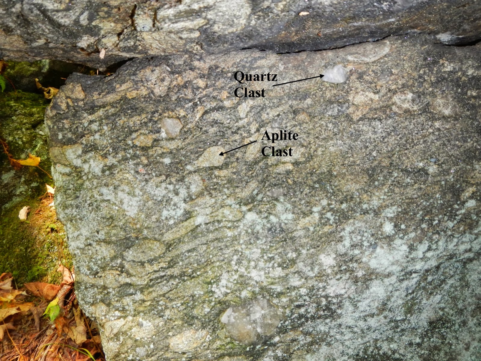
Stop 3.1 - Hoosac Schist

The Hoosac contains muscovite, quartz, and albite plagioclase (which is dark gray from graphite inclusions). After the first period of plagioclase crystal growth, the graphite was flushed out of the matrix. If a plagioclase crystal continued to grow after this flush, it could no longer draw in graphite, which is why some of the crystals have a white, graphite-less rim. The Hoosac contains alternating dark and light layers have been folded extensively (Fig. 3.1). It is unlikely that these layers are related to original bedding.
Figure 3.1. Extensive folding and intense foliation characterize the Hoosac schist

Stop 3.2 - Rowe Schist

A fine-grained schist that is silvery and spangly. Contains thin layers which are less uniformly dark and light than those in the Hoosac. This is a more aluminous rock than the Hoosac, and probably doesn't contain any albite (all the Na went into forming paragonite).

Stop 3.3 - Rowe Schist

Here the Rowe is still fine-grained, and it is difficult to mineral grains without a hand lens. The mica-rich layers look similar to those at Stop 3.2,  However, there are also a lot more quartz layers here than in the schist at stop 3.2 (Fig. 3.2). If this quartz was deposited as sediment, then this can't be a deep water rock, as the transportation potential is too low out in the ocean to transport and deposit quartz grains.
Figure 3.2. Notice the high density of white quartz layers within the boxes.

Stop 3.4 - Cruddy Black Schist

The Cruddy Black Schist is an extremely weathered rock that contains a lot of graphite that breaks easily along mica layers. Also contains many quartz layers and iron carbonates. The presence of these minerals indicates that this rock was not deposited in deep water. Black shales usually occur in anoxic environments or from rapid deposition of sediment creating a temporary anoxic environment.
Figure 3.3. Contact between the lusturous Rowe on the right and the Cruddy Black Schist on the left (outlined by dashed black line).

Stop 3.5 - Ultramafics

Very fine grained rock with a greenish color (Fig. 3.4) that can most easily be seen when rock is wet. Many people like to think of this as the product of a suture zone right at the ocean edge. Could also be a bit of mantle upwelling near the continent during rifting.
Figure 3.4. The darker green color is the fresher ultramafic surface (examples in boxes).

Stop 3.6 - Moretown

The Moretown is a combination of mafic (derived from basalt) and pelitic (derived from sediment) schists, but the contact between the two schist types is never clear cut (Fig. 3.5). The mafic schist has a massive texture, while the pelitic schist is a pinstripe rock with quartz and mafic layers. The Moretown contains many quartz veins such as those seen in Fig. 3.5, which are often accompanied by large pyrite crystals (Fig. 3.6).
Figure 3.5. Mafic schist on the left with pelitic schist adjacent. Contact highlighted by dashed black line.

Figure 3.6. Large pyrite crystals with some chalcopyrite, formed right on a quartz vein.


Summary

 On this field trip we travel away from the Laurentian passive margin that we saw in Trip 1, and move into the deeper water of the continental slope-rise. Traditionally, the Hoosac schist has been interpreted as a member of the slope-rise facies, while the Rowe has been thought of as a deep ocean deposit. In a deep ocean deposit, you expect more clay minerals and less quartz because of the lack of transport potential out in the deeper ocean. However, many units within the Rowe are quartz-rich, which signifies that it may have been deposited closer to the continent than traditionally thought.

Tuesday, November 5, 2013

Trip 4: Shelburne Falls Arc


Stop 4.1 - Moretown

Contains pinstripe unit (metamorphosed sediments) and mafic layers (dikes?). Both the dikes and the metamorphosed sediments are deformed so that they look like original bedding.

Figure 4.1. What looks like original bedding is outlined by dashed lines. But these "beds" are actually just the result of severe deformation.

The Mafic units contains needle-like grains with a strong orientation. On foliation surfaces it is possible to see the amphibole needles that have grown parallel to lineation. Certain layers are more foliated and folded than others, and less ductile layers have been pulled apart into boudinage.

Stop 4.2 - Hallockville Pond Gneiss

This gneiss started as a grano-diorite pluton that was a part of the Shelburne Falls arc. It intruded the the Moretown during the Ordovician and later experienced two deformation sequences. One produced the foliation texture and the other produced the fold texture. Both textures are younger than 475 Ma, but it is unclear when exactly they occurred.
Figure 4.2. Two textures in the Hallockville Pond gneiss: foliation and folding. The foliation is outlined by dashed lines, while a couple of fold axes have been highlighted in red.

Stop 4.3 - Hawley Formation

The Hawley is made up of sediments interlayered with mafic volcanics. The zircons from the Hawley sediments are Laurentian and the volcanics are about the same age as the Shelburne Falls arc. If the volcanics are interpreted as a part of the arc, then the piece of Gondwana would have to be very close to Laurentia in order for the Laurentian sediments to be transported into the forearc basin.
We also see epidote pods (Figures 4.3 and 4.4) that could have formed from seawater percolation, or could be the remnants of lava pillows.
Figure 4.3. Good example of the epidote pods (outlined by dashed black lines) in the mafic volcanics.
Figure 4.4. Close up view of lighter pods in the mafic volcanics.

Stop 4.4 - Core of the Shelburne Falls Dome

The dome is made of tonalite (a felsic rock with no K-spar) that was co-magmatic with mafic intrusions that lie parallel to the foliation of the tonalite. Felsic magam usually have a temperature of 600 to 700 degrees, while mafic magmas are usually at about 1200 degrees. Therefore, the intrusion history probably went something like this: the tonalite intruded and partially crystallized, then the mafic magma intruded and was chilled because it was so much hotter than the tonalite magma. Since intrusion, both the tonalite and the mafic layers have been extremly deformed. The dome also contains some late pegmatites that cross-cut the foliation (Figure 4.5).
Figure 4.5. Lighter colored, undeformed pegmatites cutting through the tonalite
Additionally, quartz veins run through much of the rock. Some cross-cut both the felsic and mafic layers, while others cross-cut only one.
Figure 4.6. Quartz veins cross-cutting both the felsic and mafic layers.
In order to get a gneissic fabric (Fig. 4.7) as strong as we're seeing in a rock of this felsic composition, very strong deformation is required. A high level of deformation was possible because the we are located deep in the pluton, where the rock is still hot and fluid during the deformation period. The severity of deformation is indicated by number of isoclinal folds in the quartz veins (Fig. 4.7). This folding is also evidence for the later formation of the pegmatites, as they are undeformed.

Figure 4.7. Intense gnessic deformation fabric with a quartz vein folded into an isoclinal fold.

Summary

The area covered in this field trip has been interpreted as arc related sediments, volcanics and intrusions. The zircons of the Moretown appear to be Gondwana zircons, not Laurentian, so it is thought that the Shelburne Falls arc intruded a fragment of Gondwana located east of the Laurentian margin (Fig. 4.8). This fragment must have been close to Laurentia because the Hawley volcanics and sediments (which are found in the forearc basin) contains Laurentian zircons. Therefore, the forearc basin was receiving sediment from both the Shelburne Falls arc/Gondwana complex and Laurentia.

Figure 4.8. Schematic diagram of the Shelburne Falls Arc intruding a fragment of Gondwana close enough to Laurentia that Laurentian sediments can be transported into the fore-arc basin. From Karabinos et al. 1998.

Monday, November 4, 2013

Field Trip 5: Basement


Stop 5.1 - Beckett Quarry - Sill intruding basement

When the magma intruded, it dissolved bits of the wall rock. Therefore, the zircons in the sill contain xenocrystic cores that indicate Laurentian basement, which is the wall rock that was intruded.
Figure 5.1. Upper contact with the darker biotite gneiss (basement). Above that there is a smaller, coarser-grained sill of the same age as the large sill.
The sill contains many pegmatites, which formed when the sill cracked during cooling.

Stop 5.2 - Beckett Quarry - Felsic sill intruding Hoosac Schist

The granite sill is bifurcated and has a foliation fabric parallel to the contact. This intrusion may be associated with forearc basin rifting, because it is difficult for small bodies like the sill to intrude without extension.
Figure 5.2. Notice the foliation (outlined by dashed lines) within the sill.
There is no contact metamorphism in the schist, indicating that either the granite was too low in temperature when it was intruded, or the schist was still pretty hot during intrusion. Large pegmatites can be found in between the sill and schist (Fig. 5.3).
Figure 5.3. Large pegmatite, which is lighter in color than the schist it has intruded.
We don't see any evidence of the Taconic orogeny. Perhaps the Acadian reset everything?

 Stop 5.3 - Felsic sill intruding Tyringham Gneiss

The coarse-grained augen-granodiorite Tyringham gneiss is intruded at many points by finer grained tonalite sills (Fig. 5.4). The augen are stretched (Fig. 5.5), a deformation which goes back to Grenvillian activity.
Figure 5.4. Contact (highlighted in red) between the tonalite on the bottom and the gneiss on the top. Notice the lack of contact metamorphism.
Figure 5.5. Stretched augen.
There is no contact metamorphism (Fig. 5.4), partly because the sill is so small, and partly because the Tyringham is already so metamorphosed that there aren't many additional reactions that could occur. The zircons in the gneiss have osillatory zoning layers: one from the initial crystallization at 1170 Ma, and one at the sill intrusion at 1000 Ma.

Stop 5.4 - Biotite gneiss located close to fault

Here, a biotite gneiss has been thrust ofer the Stockbridge Formation. The fault itself is located just east of the outcrop. The proximity of the gneiss to the fault has created a mylonitic fabric of alternating dark and light laminations (Fig. 5.6). Mylonitic fabric is formed when movement occurs at high enough temperature that minerals recrystlaize, often to as smaller grain size. It is possible to see fold noses being truncated by laminations. The mylonitic fabric is wiping out the folds, and as you look farther up the outcrop (moving away from the fault) there are more folds than by the fault.
Figure 5.6. Mylonite fabric (outlined by dashed line). The rusty color is from the weathering of biotite and magnetite.

Stop 5.5 - The top of the Cobble

The Tyringham gneiss is much less deformed here because it is farther away from the fault.  It is still foliated, but the separation into laminations is less extreme (Fig. 5.8). We don't see any folds here, so the folds seen at Stop 4 must be associated with the fault.
Parts of an amphibolite layer, which is also part of the basement, is also visible. This amphibolite layer may have acted as a plane of weakness that was exploited by the alaskite sill that is found near the top of the Cobble.
Figure 5.7. The gneiss at the top of the Cobble
Figure 5.8. Still foliated (highlighted by dashed black lines), but not to the same extent as at Stop 5.4

Summary

 This field trip takes a closer look at deformation of the basement underlying all of western Mass. The trip focuses on intrusions into the basement, specifically small felsic sills that intruded 430 and 1000 Ma. It is thought that most of the sills are associated with forearc basin rifting, because it is difficult to intrude such small bodies without extension. The Berkshire Massif may have been emplaced by thrusting, which may have begun at the start of the Acadian Orogeny.